Plotting the Ghosts: How Amateur Mappers Are Pinning Down Every Burger Joint America Forgot
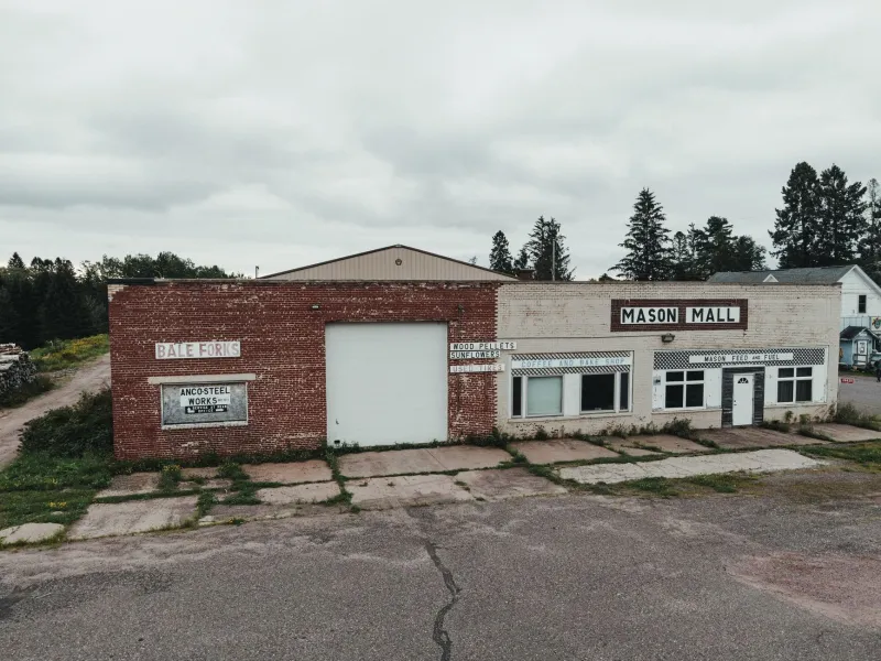
Somewhere in a suburb outside Columbus, Ohio, there's a nail salon operating inside a building with a weirdly specific roofline — a slight overhang, a drive-through lane repurposed as a side entrance, a window placement that makes no architectural sense unless you know what used to be there. It was a Roy Rogers. Or maybe a Hardee's. The records are fuzzy. But one person online almost certainly knows, and they've already dropped a pin.
That's the world of fast food cartography — an informal, mostly anonymous hobby practiced by a scattered group of people who have decided that the commercial real estate ghosts of American dining deserve to be mapped with the same rigor as anything else worth preserving.
What These People Are Actually Doing
The practice varies from person to person, but the general approach looks something like this: someone starts with a regional chain that no longer exists — Burger Chef, Rax Roast Beef, Sambo's, Kenny Rogers Roasters, or any number of others — and begins building a database of every location that chain ever operated. Then they start verifying.
Verification is where it gets interesting. Google Earth's historical imagery feature lets users scroll back through satellite photos to the late 1990s and early 2000s, which is often early enough to catch a closed location still wearing its original signage or footprint. County property records, which are increasingly digitized and searchable, show ownership transfers and zoning changes that can confirm when a building changed hands. Old phone books, scanned and uploaded to archive sites, list addresses that match up with regional news clippings about grand openings and closures.
The goal isn't just a list. It's a coordinate — a verified latitude and longitude — with photographic documentation of what's there now versus what was there before.
Why Bother?
Ask someone deep in this hobby why they do it and you'll get a range of answers, but a few themes repeat. Nostalgia is the obvious one, but it's not quite the whole story. A lot of these mappers aren't old enough to remember the chains they're documenting. They're drawn in by the puzzle of it — the way a building's bones can betray what it used to be, or the challenge of reconciling a 1987 franchise directory with satellite imagery that may or may not show the right parking lot.
There's also something quietly analytical happening. When you plot a few hundred closed locations on a single map, patterns start emerging that you wouldn't notice any other way. Regional chains collapsed in clusters that follow highway reroutes. Certain zip codes lost fast food density in waves that track almost perfectly with population shifts in the 1980s. The geography of a disappeared burger chain turns out to be a weirdly accurate map of where American economic life contracted and expanded over the last fifty years.
One mapper who documents defunct Midwestern chains described it this way in a forum post that's been shared around: "I'm not really interested in the food. I'm interested in where the money went and where the people were."
The Tools Are Better Than You'd Think
This isn't a hobby that requires expensive software or professional access. Most of the core work happens in free or low-cost tools that anyone can use. Google Earth Pro is free and contains the historical imagery archive that does a lot of the heavy lifting. The Library of Congress's digitized newspaper collection and various state-level archive projects have made old local news surprisingly searchable. Sites like Old Maps Online aggregate historical cartographic data that can show commercial zones from decades past.
For the more technically inclined, QGIS — a free, open-source geographic information system — lets mappers layer their data in ways that make the pattern analysis actually visible. Some of the more elaborate projects have produced genuinely beautiful visualizations: color-coded dots representing chains, fading in opacity based on how long ago they closed, spread across highway networks that themselves look different from how they do today.
Property record databases are the wildcard. Some counties have excellent online portals. Others require in-person visits or FOIA requests. The patchwork nature of American municipal record-keeping means that some locations get fully documented and others stay fuzzy indefinitely, which is its own kind of frustration.
The Community Is Small but Specific
This isn't a massive online movement. There's no single hub, no official Discord with thousands of members, no subreddit with viral posts hitting the front page. The people doing this work tend to operate in smaller, quieter spaces — niche forums, private Facebook groups organized around specific chains or regions, comment threads on local history blogs where someone casually mentions they've been building a spreadsheet for three years.
Occasionally a project surfaces that gets wider attention. Someone spent the better part of a year documenting every former Burger Chef location in the continental US — Burger Chef being a chain that once had more locations than McDonald's before collapsing in the early 1980s — and the resulting map circulated through local history communities with genuine enthusiasm. Local newspapers in cities where former locations appeared picked up the story. A few people recognized buildings in their own neighborhoods they'd walked past for years without understanding what they were looking at.
That recognition moment is something mappers mention repeatedly. The feeling of handing someone a coordinate and watching them realize that the weird building they've always half-noticed used to be something specific — that's apparently a significant part of the appeal.
What the Maps Actually Show
Set aside the nostalgia angle entirely and what you're left with is a genuinely useful dataset that doesn't exist anywhere else in organized form. The franchise industry's own historical records are scattered and inconsistently preserved. Corporate archives, when they exist at all, aren't publicly accessible. The only way to reconstruct the full geographic footprint of a defunct chain is to do it the hard way, location by location, source by source.
The patterns that emerge from that work are telling. Fast food geography turns out to be a surprisingly accurate proxy for other kinds of historical data — where interstates drew commercial energy away from older routes, which suburban corridors boomed and then hollowed out, which regional economies sustained local chains long after national ones had moved on. A map of dead Rax locations is also, accidentally, a map of a particular moment in Rust Belt commercial real estate. A map of vanished Sizzler restaurants tells you something real about how family dining culture shifted in the 1990s.
Nobody commissioned this research. Nobody's paying for it. It's just people with a specific kind of curiosity and enough patience to follow it somewhere useful.
The nail salon in Columbus probably doesn't know what it used to be. But somewhere online, there's a pin on a map that does.